The document outlines a roadmap to boost the gastronomy, agri-food products, and wine heritage of Bullas, Calasparra, Caravaca de la Cruz, Cehegín, Moratalla, and Mula....



Moratalla offers you an immersive walk through its vast historical and natural heritage. As a former commandery of the Order of Santiago, its landscape is defined by a monumental complex where the vestiges of ancient cultures rise above the largest forest area in the Region.
You can walk along the Alharabe River, discover the Somogil pools, or venture into places like the Bolvonegro gorge, where nature surprises with unique rock formations.
The longest and wildest route, connecting the most remote hamlets. It crosses ravines, traditional farming areas, and small forests, showcasing the purest essence of Moratalla's mountains. Check GPS details at: <a href="https://territoriolavanda.es/planifica/rutas/">https://territoriolavanda.es/planifica/rutas/</a>.
14 km | Difficulty: Medium
Route in the shadow of Benizar Castle. It takes you through Rincón de las Cuevas, an area of outstanding geological beauty where rock formations create a magical setting among springs and traditional orchards. Check the GPS details at: <a href="https://territoriolavanda.es/planifica/rutas/">https://territoriolavanda.es/planifica/rutas/</a>.
7,2 km | Difficulty: Medium
A gentle walk featuring the Spanish juniper, with ancient specimens that are true botanical gems. It's a lesson in natural survival in a harsh climate environment, perfect for kids. Check GPS details at: <a href="https://territoriolavanda.es/planifica/rutas/">https://territoriolavanda.es/planifica/rutas/</a>.
6,5 km | Difficulty: Low
Ascent to the highest lands in the Region of Murcia. It's a paradise for botany enthusiasts due to its endemic species. The landscape is vast, silent, and offers spectacular panoramic views of the surrounding mountain ranges. Check the GPS details at: <a href="https://territoriolavanda.es/planifica/rutas/">https://territoriolavanda.es/planifica/rutas/</a>.
8,7 km | Difficulty: Medium
Explore the stunning "Cenas de Zaén", natural rock shelters carved into limestone that have served as refuge since prehistoric times. The route offers a fascinating geological perspective of the Revolcadores Massif and lets you visit the Los Cantos archaeological site. Check the GPS details at: <a href="https://territoriolavanda.es/planifica/rutas/">https://territoriolavanda.es/planifica/rutas/</a>.
11,3 km | Difficulty: Medium
An itinerary that links small hamlets that seem frozen in time. It offers an authentic glimpse into Moratalla’s shepherding life, walking among centuries-old holm oaks and fields that in June and July burst into the violet colour of lavender. Check the GPS details at: <a href="https://territoriolavanda.es/planifica/rutas/">https://territoriolavanda.es/planifica/rutas/</a>.
9,2 km | Difficulty: Low
This technical and scenic route delves into the area's mining history, visiting the ancient inland salt pans known as "El Salero". The path runs through a high mountain plain where the pure air mixes with the scent of lavender. It is mostly a flat route, perfect for observing steppe birds and the dry-stone rural architecture characteristic of the Murcian Altiplano. Check GPS details at: <a href="https://territoriolavanda.es/planifica/rutas/">https://territoriolavanda.es/planifica/rutas/</a>.
10,5 km | Difficulty: Medium
A sensory journey that follows the upper course of the Benamor River. This route stands out for the contrast between the cool riverside vegetation and the arid dryland fields where aromatic plants dominate. It’s the ideal option for those who want to understand traditional water management in Moratalla while walking among old farmhouses and landscapes that change color with the seasons. Check the GPS details at: <a href="https://territoriolavanda.es/planifica/rutas/">https://territoriolavanda.es/planifica/rutas/</a>.
12,8 km | Difficulty: Low
This branch of the GR 7 is a specific 62.7-kilometer trail that directly connects the towns of Moratalla and Caravaca de la Cruz. With moderate difficulty due to the elevation changes typical of the northwestern Murcia terrain, the GR 7.1 is an excellent option for a 2 to 3-day trek, offering a route that combines natural landscapes with a strong cultural and spiritual component. The trail begins in Moratalla, a mountain village with particular charm, and enters a natural environment that includes ravines, river valleys, and pine forests. The route winds through the rural and mountainous landscape, often following the course of rivers such as the Alhárabe or the Argos, which carve deep and fertile valleys. Hikers experience a sense of immersion in the most pristine nature of the Northwest, with the possibility of spotting local wildlife and enjoying the tranquility of its forests. As the route approaches Caravaca de la Cruz, the pilgrimage character becomes more evident. The trail becomes part of the Ways of the Cross, culminating at the Basilica-Sanctuary of the Vera Cruz, the final destination for pilgrims. This GR 7.1 not only offers a physical challenge but also a deep connection with the history and traditions of the region, linking two of its most significant towns through a landscape that invites reflection and enjoyment of nature. The Town Council of Caravaca de la Cruz is not responsible for the content of published texts or the state of signage, maintenance, or safety of the routes described.
62,7 km | Difficulty: Medium
The GR 7, part of the ambitious European Long-Distance Path E4 that crosses the continent, traverses the Region of Murcia from east to west for 170 kilometers. As it passes through the region, this GR is of particular interest to the municipalities of Calasparra and Moratalla, offering a hiking experience of varying difficulty, ranging from moderate to difficult in certain mountainous sections. Completing the Murcian stretch can take between 7 and 8 days, allowing for a deep immersion in the regional geography. The trail boasts extraordinary landscape diversity, starting in the Altiplano, with its mountain ranges and plains, before entering the Northwest region. In Calasparra, the GR 7 approaches the Segura River, offering views of the surroundings of the Sanctuary of La Esperanza and the majestic Almadenes Canyon, a natural gorge of great beauty and ecological value. This section allows visitors to appreciate the interaction between the river landscape and the rock formations. As the GR 7 advances towards Moratalla, the terrain becomes more mountainous, delving into mountain areas and Mediterranean forests. The trail winds through rugged landscapes, hidden valleys, and areas of great ecological value, such as the vicinity of Revolcadores, the highest peak in the Region of Murcia. It is a route that not only challenges hikers with its elevation changes but also rewards them with the tranquility of its natural settings, the richness of its flora and fauna, and the authenticity of its villages, offering a complete vision of Murcia's wildest and most inland areas.
170 km | Difficulty: Medium
Spanning 134 kilometers, the GR 251 is one of the "Caminos de la Cruz" (Ways of the Cross) that converges in Caravaca, starting from the Altiplano wine-growing region. This moderate-difficulty trail directly links the municipalities of Calasparra, Moratalla, and Caravaca de la Cruz, offering a fascinating journey through landscapes that contrast vineyards with rugged mountains and river plains. The estimated time to complete it on foot is 5 to 6 days, depending on your pace and stops. The route begins in the plains and mountains of the Altiplano, featuring extensive vineyards and arid landscapes that evoke the essence of the interior. As it moves west, the trail enters the Northwest region, where the scenery transforms. In Calasparra, the path skirts the famous rice fields that the town is known for and approaches the Sanctuary of Nuestra Señora de la Esperanza, a site of great devotion carved into the rock beside the Segura River. Here, the GR 251 often overlaps or crosses with the GR 7 and the GR 127 (Segura River), offering opportunities to diversify your hiking experience. Continuing toward Moratalla, the path crosses mountain areas and river valleys, such as those of the Alhárabe and Benamor rivers, offering panoramic views and the chance to explore untouched natural environments. Finally, the trail culminates at the Basilica-Sanctuary of the Vera Cruz in Caravaca, a perfect finish to a route that connects not only geographies but also traditions and the region's deep connection to its roots. It is a route that combines natural beauty with a strong cultural and spiritual character. The Caravaca de la Cruz Town Council is not responsible for the content of the published texts or the condition of the signage, maintenance, or safety of the described routes.
134 km | Difficulty: Medium
Family-friendly route starting from Camping La Puerta, following the GR-7 to the thermal pools of Pozas de Somogil and returning along the riverbed of the río Alhárabe, passing waterfalls and the Pozas de La Puerta. Easy sections with some short rock scrambling; take care with water flow after rain. Perfect in summer to combine hiking and swimming.
8,4 km | Difficulty: Medium
From the Fuente de los Almeces recreational area, the route reaches the limestone summit of Peña Jarota (1,496 m) and then descends to the historic Santuario de La Rogativa (16th–18th centuries), set on a natural balcony overlooking the valley. Mixed forests, karstic limestone plateaus, and great views of the Revolcadores massif; very popular in winter and spring, often with a light layer of snow.
14,7 km | Difficulty: Medium
From the village of Inazares, the route climbs along old livestock paths and through centuries-old juniper groves to the summit of Obispo, the highest point in the Región de Murcia. 360° views of Sierra de Segura and La Sagra. Route marked by the FMRM; warm clothing and water are essential, with snow common in winter. Best between April and November.
7,2 km | Difficulty: High
Final stage of the GR-251. From Calasparra train station, the route climbs to Alto de San Miguel (viewpoint chapel), crosses the tunnel under the RM-730, and joins rural tracks that, between cortijos and wide wheat fields, lead to the Alhárabe River valley and the La Puerta campsite (Moratalla). Good training to then continue on the GR-7/GR-7.1 towards Caravaca. Ideal in spring and autumn.
27,8 km | Difficulty: Low
Well-marked pilgrim variant that leaves Moratalla via the bridge over the Benamor River and runs through pine forests, rolling cereal fields, and small hamlets before reaching views of the Vera Cruz sanctuary-fortress in Caravaca. With no major elevation gain (≈150 m +), it is ideal from September to May; bring water, as there are no fountains along the way.
17 km | Difficulty: Low
The last two stages of the GR-7 in Murcia: first, the route follows the Alhárabe River valley, passing pools and pine forests up to Collado del Majal Alto; then it crosses the hamlets of La Risca, El Sabinar, and Calar de la Santa عبر Campo de San Juan, before reaching Puerto Hondo and arriving at the high plateau of Cañada de la Cruz at over 1,300 m. The route combines trails, tracks, and short asphalt sections; limited water, ideal in spring or autumn.
58 km (2 jornadas) | Difficulty: Medium
This stage starts near the Santuario de la Esperanza and the rice fields of Calasparra, crosses tunnels under the RM-714 road, and gently climbs through cereal crops and almond groves. After crossing the Moratalla River, the final kilometers offer wide views of the town of Moratalla before descending to the Camping La Puerta area. Signage is good except for a few confusing junctions; recommended from September to May to avoid the heat.
24,9 km | Difficulty: Low
The Sendero del Estrecho de Bolvonegro is a natural gem in Moratalla, running through a spectacular gorge carved by the Alhárabe River. The route, of moderate difficulty due to some more technical or uneven sections, offers an immersive experience in a unique microclimate. The trail winds alongside the riverbed, flanked by imposing limestone walls and lush riverside vegetation. A sense of freshness and the sound of flowing water accompany much of the journey. It is an ideal place for birdwatching and for enjoying the scenic beauty of a river canyon, with pools and small waterfalls that invite contemplation, especially in spring and autumn.
6 km | Difficulty: Medium
The document outlines a roadmap to boost the gastronomy, agri-food products, and wine heritage of Bullas, Calasparra, Caravaca de la Cruz, Cehegín, Moratalla, and Mula....
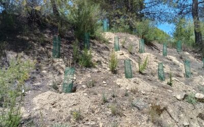
The Association of Tourism Services of the Northwest Region of Murcia has carried out a project to improve the green infrastructure of the "Ruta Verde" (Green Route),...

The Northwest Tourism Services Association continues to advance the modernization and digitalization of the tourism offerings in its member municipalities by acquiring...
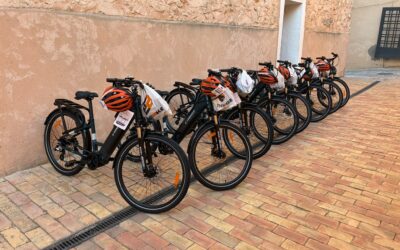
La Mancomunidad de Servicios Turísticos del Noroeste de la Región de Murcia continúa avanzando en la transformación del modelo turístico del territorio con la...
PRESS RELEASE Boosting the tourism sector in Northwest Murcia through a business mentoring program funded by NextGenerationEU The Northwest Region of Murcia, under the...

The Mayor, Juan Soria, and the Councillor for Sports, Julián Sánchez, received the distinction awarded by the Orienteering Federation of the Region of Murcia במסגרת the...
Accommodation
Businesses
Gastronomy
Places
Routes
Accommodation
Businesses
Gastronomy
Places
Routes