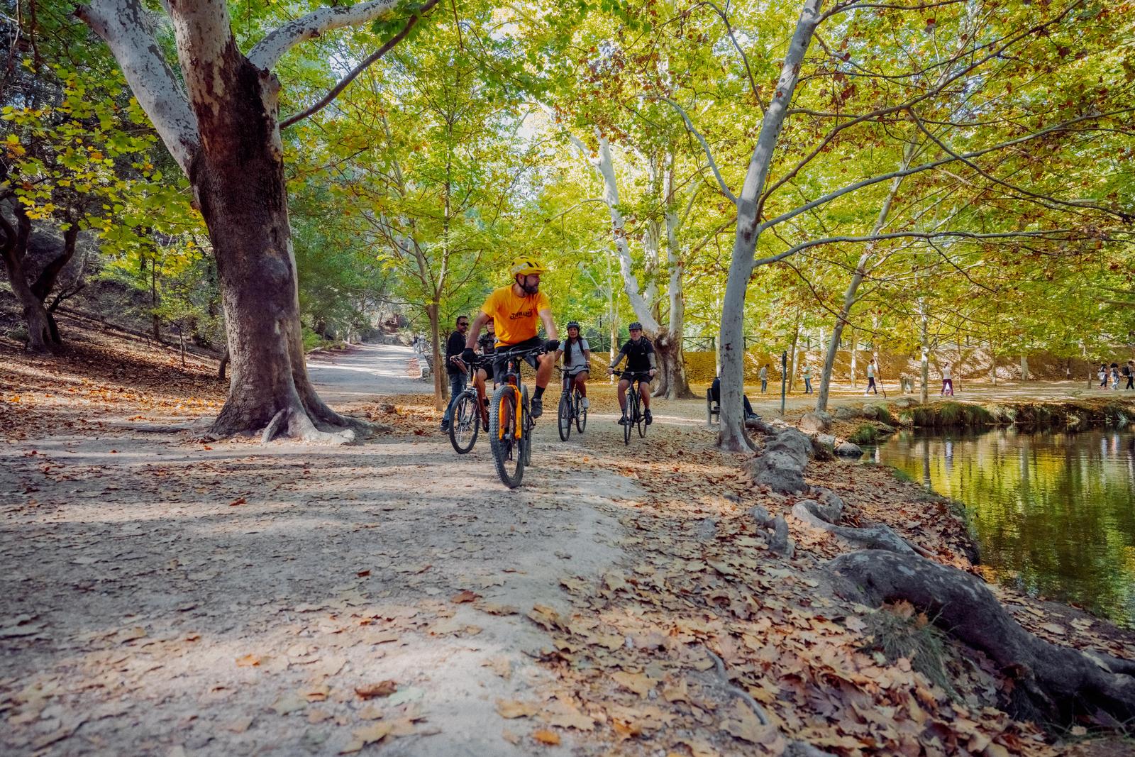
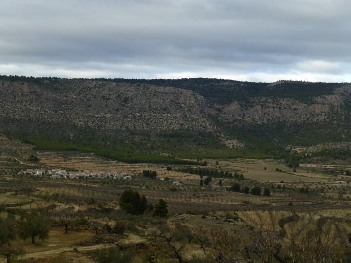
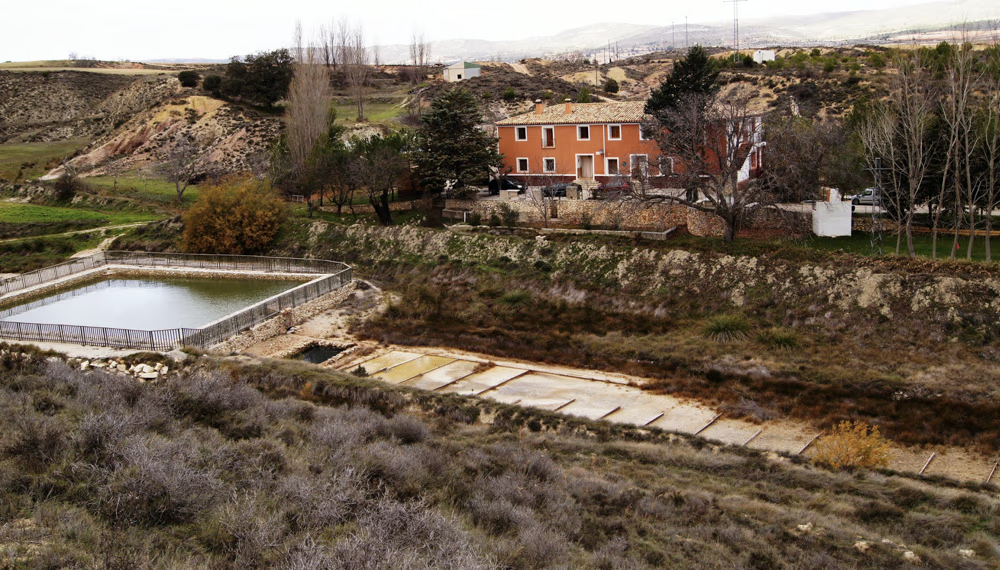
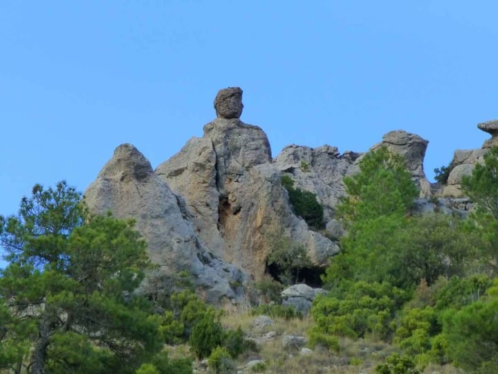
If you are a lover of nature and hiking, here you will find all the outdoor routes for all levels and disciplines.
It doesn’t matter if you’re more into biking, trail running, camping or just walking, we know every corner of our territory and we show it to you so that you too can get to know it.
MOST POPULAR ROUTES
Discover paths surrounded by history, unique landscapes and tradition. We have compiled the best and most popular routes for you to live an authentic experience and plan your hiking day.
DISCOVER ALL THE ROUTES
Check out all the routes that the northwest region of Murcia has to offer. Explore hidden natural landscapes, small circular routes or ascents with spectacular views.
Advanced-level route for lovers of pure MTB, between the municipalities of Caravaca de la Cruz and Moratalla. You'll enjoy the most authentic landscapes and areas completely removed from civilization where you'll test your fitness and your skills on the bike. Dirt tracks, trails, paths... As the finishing touch to your experience, make sure to book at one of the restaurants you'll find on turismocaravaca.com
Circular route from Parroquia El Salvador passing through:
- Fuente Nevazo (26.4 km)
- Nevazo de abajo (28.7 km)
- Fuente los frailes (31.0 km)
- Templete (32.9 km)
Ready to test your fitness? You'll need to give it your all on this route. You'll find powerful climbs like the Collado de La Cruz de Caravaca, the finish of the 9th stage of the 2023 Vuelta a España, which will send your endorphins to stratospheric levels. When you finish this route, you're going to need a good refreshment at one of the restaurants in Caravaca. Pro tip: Book in advance!
Circular route from El Salvador Parish passing through:
- Fuente los frailes (2.2 km)
- Collado del Castillico (6.5 km)
- La Alberquilla (8.6 km)
- Cortijo de los Álamos (38.9 km)
- Cuevas del Marqués (85.8 km)
Explore the rural world of Caravaca de la Cruz. This intermediate-level road route allows you to discover the municipality's most beautiful backroads. Enjoy traffic-free areas, filled with diverse landscapes that will surprise you. Upon your return, to perfectly conclude this adventure, we recommend reserving a table at one of Caravaca's restaurants where you can savor the typical local cuisine and stroll through the historic old town. What are you waiting for to get started!
Intermediate-level route that will take you through much of the municipality of Caravaca. Get ready to discover some of its best-kept secrets, known to very few people. From archaeological sites, natural water springs, historic buildings, the ethnic music museum in Barranda, and a contrast of unique landscapes in the Region of Murcia. The route surface is 70% road, 30% dirt tracks.
Get your bike ready for this great adventure through rural and authentic lands—you're going to love it!
An easy circular bike route for everyone. It follows part of the Camino de Levante. Our route starts and ends at Plaza del Arco, in Caravaca’s historic centre. We’ll visit the natural area of Las Fuentes del Marqués. Then we’ll head towards Cehegín, riding along part of the Camino de Levante, a route used by pilgrims on their spiritual journey from Orihuela to Caravaca. Ready to enjoy a different kind of experience?
A very easy circular route for the whole family. Discover some of the most iconic landmarks, such as El Templete, and the most beautiful natural landscapes of Caravaca like Las Fuentes del Marqués. The start and finish of our route will be from Plaza del Arco, in the historic center of Caravaca. A bike route for users eager to embark on new adventures with family or friends. We hope you enjoy it!
The longest and wildest route, connecting the most remote hamlets.
It crosses ravines, traditional farming areas, and small forests, showcasing the purest essence of Moratalla's mountains.
Check GPS details at:
https://territoriolavanda.es/planifica/rutas/.
Route in the shadow of Benizar Castle. It takes you through Rincón de las Cuevas, an area of outstanding geological beauty where rock formations create a magical setting among springs and traditional orchards.
Check the GPS details at:
https://territoriolavanda.es/planifica/rutas/.
A gentle walk featuring the Spanish juniper, with ancient specimens that are true botanical gems.
It's a lesson in natural survival in a harsh climate environment, perfect for kids.
Check GPS details at:
https://territoriolavanda.es/planifica/rutas/.
Ascent to the highest lands in the Region of Murcia. It's a paradise for botany enthusiasts due to its endemic species.
The landscape is vast, silent, and offers spectacular panoramic views of the surrounding mountain ranges.
Check the GPS details at:
https://territoriolavanda.es/planifica/rutas/.
Explore the stunning "Cenas de Zaén", natural rock shelters carved into limestone that have served as refuge since prehistoric times.
The route offers a fascinating geological perspective of the Revolcadores Massif and lets you visit the Los Cantos archaeological site.
Check the GPS details at:
https://territoriolavanda.es/planifica/rutas/.
An itinerary that links small hamlets that seem frozen in time.
It offers an authentic glimpse into Moratalla’s shepherding life, walking among centuries-old holm oaks and fields that in June and July burst into the violet colour of lavender.
Check the GPS details at:
https://territoriolavanda.es/planifica/rutas/.
This technical and scenic route delves into the area's mining history, visiting the ancient inland salt pans known as "El Salero".
The path runs through a high mountain plain where the pure air mixes with the scent of lavender. It is mostly a flat route, perfect for observing steppe birds and the dry-stone rural architecture characteristic of the Murcian Altiplano.
Check GPS details at:
https://territoriolavanda.es/planifica/rutas/.
A sensory journey that follows the upper course of the Benamor River. This route stands out for the contrast between the cool riverside vegetation and the arid dryland fields where aromatic plants dominate.
It’s the ideal option for those who want to understand traditional water management in Moratalla while walking among old farmhouses and landscapes that change color with the seasons.
Check the GPS details at:
https://territoriolavanda.es/planifica/rutas/.
Our route begins at the spot known as “Los Viveros,” which is accessed via the turn-off from the road leading to the Sanctuary of La Esperanza.
Following the paved path for about half a kilometer north, we find a dirt track on the left that will lead us to the Moratalla River. We cross the riverbed at a designated crossing point, arriving at the area of La Huertecica. This spot is notable for its traditional fruit and vegetable crops. The path then takes us into a lush gallery or riparian forest that grows on both sides of the Segura River's course. A characteristic of this forest is that the vegetation is perfectly adapted to the soil's humidity conditions.
This section along the river coincides with the GR-127, which covers a large part of the river's course.
The route continues along a path of about 700 m next to the left bank of the river, among white poplars, black poplars, ash trees, hackberry trees, tamarisks, willows, osiers, brambles, oleanders, reeds, common reeds, etc. The water quality in this section of the Segura River allows otters to thrive in perfect conditions, although they are difficult to spot due to their elusive behavior towards humans. We can also see and hear a multitude of songbirds and aquatic birds, such as the common nightingale, the golden oriole, the blackbird, the long-tailed tit, the green woodpecker, the bee-eater, the kingfisher, the grey heron, the cormorant, the mallard, etc.
Upon leaving the riparian forest, we take the path on the left that ascends to a viewpoint, from which we can enjoy a panoramic view of the riparian forest nestled among mountains with drought-adapted scrubland.
From the viewpoint, we continue along the dirt path through esparto grass fields towards the west.
Approximately one kilometer later, we take the first path we find on the left, heading southeast, which will lead us to the Moratalla River. We cross the riverbed again, arriving at the farmhouse known as Casa del Cura. Continuing our journey, we ascend the Lomas de las Torrentas until we reach Cañada Manrique.
From this point, a path branches off through a pine forest, which will lead us to a paved road, taking us back to the starting point.
Enjoy this circular route with a morning walk through the heart of the Rice-Growing Plain to discover the biodiversity of this birdwatching area and its riverside vegetation.
An ecotourism date with the river landscapes of the Plain.
Camino del Olivarejo towards Villa Vieja
River footbridge
Canoeing School
Rotas beauty spot
Birdwatching area
Asparagus grove
Historic centre
More info: https://calasparrarutasdelarroz.es/ruta-26-06-2021/
The "Ruta las Fuentes" is a circular route that tells the story of a time in Calasparra's history when the priorities of the day made the esparto grass industry and the exploitation of the centuries-old salt flats a key part of the town's economic engine.
A walk where you'll find a striking contrast of landscapes and different color tones in the earth along certain sections of the path, such as the "Los Coloraos" area, where the predominant color makes this environment a very representative place due to its unique chromatic character.
A trail of contrasts where water takes center stage at three spots along the way: the legendary Morcillo, Llano, and Cobre springs.
They are part of this extraordinary route alongside the Rambla de los Arcos riverbed and its monumental Aqueduct, witnesses to various episodes in the history of Calasparra.
Scenic itinerary:
Balsas de Higinio | Fuente Morcillo | Fuente del Llano | "Los Coloraos" area | Fuente del Cobre | Rambla de los Arcos | Salero Viejo | Acueducto de los Arcos.
More info: https://calasparrarutasdelarroz.es/ruta-de-las-fuentes-2023/
The El Bayo Trail is a circular route of about 6 km that runs through rice fields, irrigation channels, and the banks of the Segura River in Calasparra. It is an easy walk suitable for inexperienced hikers. Distinguished with the Blue Trail award.
More info: https://calasparrarutasdelarroz.es/ruta-30-31-05-2025/
Circular route from Calasparra passing by the Pozo shelters on the banks of the Segura River, the Casa de las Horyicas, and the rice fields of Soto de la Boquera next to the Esparragal irrigation channel.
More info: https://calasparrarutasdelarroz.es/la-siega-soto-de-la-boquera-2025/
The GR 127 is a river trail that follows the course of the Segura River from the Cenajo reservoir to its mouth, offering a route that, in its section through the Region of Murcia, crosses key municipalities such as Calasparra and passes through the hamlet of Salmerón in Moratalla.
Although its total length is not defined by a single figure, it is divided into significant stages, such as the one from Calasparra to Cieza (35 km), and is characterized by easy to moderate difficulty, as the elevation changes are generally gentle when following the river course, although the length of the stages can be considerable.
The essence of the GR 127 lies in its deep connection with water and riverside landscapes. In Calasparra, the route allows hikers to immerse themselves in the heart of the famous rice fields, a landscape of great beauty and uniqueness, especially during the rice growing seasons. The trail also leads to the Sanctuary of Our Lady of Hope, an iconic site carved into the rock beside the river, which is a pilgrimage point and a major tourist attraction.
In addition, the GR 127 offers privileged views and access to the impressive Almadenes Canyon, a natural gorge carved by the Segura between Calasparra and Cieza, with its imposing vertical walls and prehistoric caves. The trail also crosses fertile plains, historic bridges, and areas of riverside vegetation, providing a rich and diverse ecosystem. It is a route that allows you to understand the importance of the Segura River in the history and development of the Region of Murcia, offering a peaceful experience deeply connected to the river landscape.
The Caravaca de la Cruz Town Council is not responsible for the content of published texts or the state of signage, maintenance, or safety of the routes described.
This branch of the GR 7 is a specific 62.7-kilometer trail that directly connects the towns of Moratalla and Caravaca de la Cruz. With moderate difficulty due to the elevation changes typical of the northwestern Murcia terrain, the GR 7.1 is an excellent option for a 2 to 3-day trek, offering a route that combines natural landscapes with a strong cultural and spiritual component.
The trail begins in Moratalla, a mountain village with particular charm, and enters a natural environment that includes ravines, river valleys, and pine forests. The route winds through the rural and mountainous landscape, often following the course of rivers such as the Alhárabe or the Argos, which carve deep and fertile valleys. Hikers experience a sense of immersion in the most pristine nature of the Northwest, with the possibility of spotting local wildlife and enjoying the tranquility of its forests.
As the route approaches Caravaca de la Cruz, the pilgrimage character becomes more evident. The trail becomes part of the Ways of the Cross, culminating at the Basilica-Sanctuary of the Vera Cruz, the final destination for pilgrims.
This GR 7.1 not only offers a physical challenge but also a deep connection with the history and traditions of the region, linking two of its most significant towns through a landscape that invites reflection and enjoyment of nature.
The Town Council of Caravaca de la Cruz is not responsible for the content of published texts or the state of signage, maintenance, or safety of the routes described.
The GR 7, part of the ambitious European Long-Distance Path E4 that crosses the continent, traverses the Region of Murcia from east to west for 170 kilometers. As it passes through the region, this GR is of particular interest to the municipalities of Calasparra and Moratalla, offering a hiking experience of varying difficulty, ranging from moderate to difficult in certain mountainous sections. Completing the Murcian stretch can take between 7 and 8 days, allowing for a deep immersion in the regional geography.
The trail boasts extraordinary landscape diversity, starting in the Altiplano, with its mountain ranges and plains, before entering the Northwest region. In Calasparra, the GR 7 approaches the Segura River, offering views of the surroundings of the Sanctuary of La Esperanza and the majestic Almadenes Canyon, a natural gorge of great beauty and ecological value. This section allows visitors to appreciate the interaction between the river landscape and the rock formations.
As the GR 7 advances towards Moratalla, the terrain becomes more mountainous, delving into mountain areas and Mediterranean forests. The trail winds through rugged landscapes, hidden valleys, and areas of great ecological value, such as the vicinity of Revolcadores, the highest peak in the Region of Murcia.
It is a route that not only challenges hikers with its elevation changes but also rewards them with the tranquility of its natural settings, the richness of its flora and fauna, and the authenticity of its villages, offering a complete vision of Murcia's wildest and most inland areas.
Spanning 134 kilometers, the GR 251 is one of the "Caminos de la Cruz" (Ways of the Cross) that converges in Caravaca, starting from the Altiplano wine-growing region. This moderate-difficulty trail directly links the municipalities of Calasparra, Moratalla, and Caravaca de la Cruz, offering a fascinating journey through landscapes that contrast vineyards with rugged mountains and river plains. The estimated time to complete it on foot is 5 to 6 days, depending on your pace and stops.
The route begins in the plains and mountains of the Altiplano, featuring extensive vineyards and arid landscapes that evoke the essence of the interior. As it moves west, the trail enters the Northwest region, where the scenery transforms. In Calasparra, the path skirts the famous rice fields that the town is known for and approaches the Sanctuary of Nuestra Señora de la Esperanza, a site of great devotion carved into the rock beside the Segura River.
Here, the GR 251 often overlaps or crosses with the GR 7 and the GR 127 (Segura River), offering opportunities to diversify your hiking experience.
Continuing toward Moratalla, the path crosses mountain areas and river valleys, such as those of the Alhárabe and Benamor rivers, offering panoramic views and the chance to explore untouched natural environments.
Finally, the trail culminates at the Basilica-Sanctuary of the Vera Cruz in Caravaca, a perfect finish to a route that connects not only geographies but also traditions and the region's deep connection to its roots. It is a route that combines natural beauty with a strong cultural and spiritual character.
The Caravaca de la Cruz Town Council is not responsible for the content of the published texts or the condition of the signage, maintenance, or safety of the described routes.
This Long-Distance Trail, spanning nearly 140 kilometers divided into 5 stages, stands as another artery of the "Caminos de la Cruz" (Ways of the Cross) leading to Caravaca de la Cruz, starting from the coast of Mazarrón and the Bajo Guadalentín region.
Its difficulty varies, with moderate sections and some, like the one crossing Sierra Espuña, demanding considerable physical effort, making it an attractive challenge for experienced hikers. The municipalities of Mula (via Zarzadilla de Mula), Bullas, Cehegín, and Caravaca de la Cruz are part of its extensive route.
The route is a mosaic of Murcian landscapes and ecosystems. It begins in a coastal environment, ascends towards the impressive formations of Sierra Espuña, a Regional Park of immense ecological value with dense forests and rugged terrain. In this mountain range, the trail offers spectacular panoramic views and the opportunity to connect with unspoiled nature. As it progresses, the GR 252 ventures inland, crossing river valleys such as the Pliego River and the Mula River, agricultural areas, and places of unique beauty.
Numerous points of interest adorn the path, inviting visitors. The route overlaps with sections of other greenways, such as the Mazarrón to La Pinilla Greenway and the Cartagena to Totana Greenway, and even converges with the Northwest Greenway in its final stretch towards Caravaca, facilitating the interconnection of routes. The trail passes through small villages and hamlets like El Berro, Gebas, or Zarzadilla de Mula, offering an immersion into Murcian rural life and culminating, like other Caminos de la Cruz, at the emblematic Sanctuary of the Vera Cruz, making this GR a complete experience of nature, culture, and spirituality.
The Caravaca de la Cruz City Council is not responsible for the content of the published texts or the condition of signage, maintenance, or safety of the described routes.
The GR 250 is a Long-Distance trail that's part of the vast "Caminos de la Cruz" network, designed to connect the port city of Cartagena with the sacred Caravaca de la Cruz. Stretching over 143.49 kilometers, this path offers a moderate hiking experience, with stages that vary in length and elevation gain, and can be completed in about 6-7 days. Its route runs through the municipalities of Mula, Bullas, Cehegín, and Caravaca de la Cruz, making it a central route for exploring this region.
The diverse landscape is one of its main highlights. The trail starts on the coast and progressively heads into the interior of the Region of Murcia, crossing the Campo de Cartagena, the fertile plains of the Segura and Mula rivers, and the Northwest regions.
A distinctive feature of this GR is its use of sections of the Northwest Greenway, which makes progress easier in certain parts and lets you enjoy its infrastructure and scenery.
Along the way, hikers will find numerous points of cultural and natural interest. In Mula, you can visit its old town and rural surroundings. Passing through Bullas, you'll dive into its winemaking tradition and characteristic landscape. Cehegín surprises with the Begastri Archaeological Park, a site of great historical value that tells the story of human occupation since ancient times.
Finally, the route ends in Caravaca de la Cruz, the city of the Vera Cruz, with its impressive sanctuary and rich religious and cultural heritage. The Apostle's Way isn't just a trail, but a journey through the history and soul of the Region of Murcia.
Caravaca de la Cruz City Council is not responsible for the content of the published texts or the condition of the signage, maintenance, or safety of the described routes.
Utilizing the old railway line between Murcia and Caravaca de la Cruz, whose construction began in 1925 and concluded in 1931, the Vía Verde (Greenway) stretches for nearly 78 km, passing through lush orchards, pine forests, and the most beautiful spots. Along its route, hostels are set up in old train stations. This route constitutes the final stretch of the Camino de Levante, the pilgrimage route to the Holy City of Caravaca de la Cruz.
From the Coto Real hostel, the trail climbs through Mediterranean pine forests and follows the Barranco del Canalón to the Águilas viewpoint (1,000 m). Views of the Lavia and Espuña mountain ranges; picnic option at Fuente el Piojo. Avoid hot days, and it’s highly recommended at sunrise in autumn.
From the cobblestone streets of Cehegín, you descend into the Quípar valley and climb the hill where Begastri stands—an Ibero-Roman oppidum and later a Visigothic episcopal see. Enjoy 360° viewpoints, olive groves, and almond trees. This cultural route is ideal year-round, except during the peak heat of summer.
A circular walk through the Baroque-Mudéjar historic center, declared a "2019 Rural Wonder." Explore the Plaza del Mesoncico, the Church of Sta. María Magdalena, the modernist Casino, and noble palaces like Casa Jaspe. Perfect as a self-guided tour with interpretive panels.
Forest route linking the Cambrones (605 m) and Encaramador (638 m) hills within the Coto de las Maravillas multi-adventure park. Shaded Aleppo pine trails, natural viewpoints, and family facilities (picnic areas, zip line, nature classroom). A great plan for winter-spring; in summer, it's best to start early.
This route is the main way to explore Cehegín on foot and is fully integrated into the Northwest Greenway trail. Designed as a "healthy route" to encourage physical activity, it is a fully accessible, flat, and well-signposted path, ideal for walking, running, or cycling. The route crosses the rural surroundings of Cehegín, with views of its farmland and the Quípar River valley. A key point of interest is its proximity to the Begastri Archaeological Park, an ancient Iberian and Visigothic settlement that offers a fascinating journey into the past. The route combines the ease of a former railway line with the opportunity to explore Cehegín's rich historical and natural heritage, making it perfect for all audiences.
The Senda del Tiempo (Path of Time) takes place within the municipality of Mula, across the city's urban and peri-urban areas, connecting several sites of natural, cultural, and scenic interest. It is an itinerary that can be done in both directions and starts and ends at the Vía Verde del Noroeste, making it a circular trail. Whether you start the route by the La Puebla de Mula cemetery or at the intersection of Gran Vía and the Mula bypass, near Camino de la Tejera, you will cover a total of 7.5 km.
The PR-MU 78 is a circular route that combines mountain and rural landscapes in the northern part of the Sierra Espuña Regional Park. It begins in the picturesque village of Casas Nuevas, at 500 meters altitude, where the contrast between the rugged mountain range and traditional crops sets the tone for the route.
https://es.wikiloc.com/rutas-senderismo/pr-mu-78-umbria-del-bosque-casas-nuevas-mula-90183235
The Albacar Trail is a network of paths that explores the agricultural landscape and ravines around Mula, with a special focus on the distinctive formations of this area. Albacar may refer to an old irrigation channel or a local place name. The route runs through dry farmland, where you can see almond and olive trees, and heads into ravines that erosion has gradually carved out. It offers views of semi-desert landscapes and nearby mountain ranges, making it a route that connects you with the arid character and natural beauty of Spain’s southeastern peninsula.
This trail is not a single linear route, but a series of paths and sections that explore Mula’s vital connection with water, mainly through its huertas and acequias. It runs through irrigated farmland, past old waterwheels, mills, and the channels that distribute water across the vega of the río Mula. It is an ideal route for families, with very flat and accessible sections, allowing visitors to understand the importance of the traditional irrigation system and enjoy the lush vegetation of the huerta, as well as offering spots to cool off by the water.
The Ruta de los Vélez follows the monumental legacy left by the Casa de los Vélez in Mula, linking the main landmarks connected to its history and power, with Castillo de los Vélez as the central highlight. A perfect walk to discover the city from its best viewpoints and most iconic architecture.
This route is an interpretive walk through the historic center of Mula, focusing on the Renaissance and Baroque heritage that often goes unnoticed in its streets. The route takes you through squares and corners where palaces, mansions, and façades with noble coats of arms stand, revealing the town’s history through its architecture. Although short, its difficulty lies in the steep alleys and stairways typical of a fortified town. It is an ideal cultural route to discover the artistic richness of Mula.
The Sendero de la Mulata is a circular route that explores the rural and forest surroundings of Calasparra. It combines sections of track with easier paths, passing through pine forests, scrubland, and cultivated areas. It is a low-difficulty route, suitable for a family walk or for those looking to enjoy nature in a relaxed way. It offers the opportunity to observe local flora and fauna and enjoy the tranquility of the Murcian countryside.
This is the shortest route in the Calasparra trail network, designed for quick and easy access to Cabezo Negro, a small elevation that serves as a natural viewpoint. Despite its brevity, it offers a different perspective of the surroundings, allowing visitors to observe nearby landscapes with minimal effort. It is perfect for a very short walk or as a complement to longer routes.
The Ruta de la Vega Arrocera is a deep immersion into the most emblematic agricultural landscape of Calasparra. The trail follows flat tracks across extensive rice fields, allowing visitors to observe the entire cultivation cycle up close, from the flooding of the fields to the harvest, depending on the time of year. It is a highly visual and sensory route, where you can enjoy the reflections of the sky in the water, the changing colors of the rice fields, and the sounds of water birds. Ideal for a peaceful and cultural walk to understand the importance of this crop in the region.
Despite its short distance, this route has a moderate difficulty due to a concentrated ascent to reach a high point in the Sierra de San Miguel. The effort is rewarded with spectacular panoramic views of Calasparra, its rice fields, the río Segura, and the surrounding sierras. It is an ideal route for those looking for a quick but rewarding hike, with an elevation gain that offers a small challenge and an immediate visual reward.
A trail designed for tranquility and enjoyment of the agricultural and forest landscape near the town center. It follows flat and gentle paths, crossing cultivated areas, small woodlands, and Mediterranean scrubland. The name “Paz” suggests its relaxing nature and its suitability for meditative or family walks. It is an accessible route that allows visitors to disconnect and reconnect with nature close to the town.
This route ventures into the impressive Cañón del Río Argos, a gorge carved by water that offers landscapes of great natural beauty. The trail winds along the river through dense riverside vegetation and towering rock walls. The moderate difficulty is due to some more technical or uneven sections of terrain. It is an opportunity to explore a unique river ecosystem, with pools and small waterfalls, and to enjoy the coolness of the canyon, a refuge during the hottest months.
These trails are key routes to reach the Santuario de Nuestra Señora de la Esperanza, a place of great devotion and natural beauty carved into the rock beside the río Segura. Each variant offers a slightly different approach, but all share the connection to this unique site. The Sendero de Peregrinos is the most traditional, while Atajo and El Olivarejo provide alternative options. All run over easy terrain, often along the river or through wooded areas, ideal for a शांत and reflective walk to one of the most iconic places in Calasparra.
A short and very interesting route that combines heritage and curiosity. This trail focuses on the ascent to Castillo de Calasparra, offering panoramic views of the town and the vega. The main highlight is the “Tunelillos”, a series of passages carved into the rock that were part of old communication routes or fortifications, providing a unique and somewhat mysterious experience. It is a family-friendly and educational walk, perfect for a quick introduction to local history.
This route is a pleasant walk through the heart of Calasparra, designed to discover the town’s cultural and historical heritage. It follows the streets of the old town, passing through emblematic squares, historic buildings, and landmarks such as Iglesia de San Pedro Apóstol and Castillo de Calasparra. It is ideal for a relaxed afternoon stroll, to get to know the essence of the town and its history, and to enjoy the local gastronomy in its bars and restaurants. Its low difficulty makes it accessible to everyone.
Family-friendly route starting from Camping La Puerta, following the GR-7 to the thermal pools of Pozas de Somogil and returning along the riverbed of the río Alhárabe, passing waterfalls and the Pozas de La Puerta. Easy sections with some short rock scrambling; take care with water flow after rain. Perfect in summer to combine hiking and swimming.
From the Fuente de los Almeces recreational area, the route reaches the limestone summit of Peña Jarota (1,496 m) and then descends to the historic Santuario de La Rogativa (16th–18th centuries), set on a natural balcony overlooking the valley. Mixed forests, karstic limestone plateaus, and great views of the Revolcadores massif; very popular in winter and spring, often with a light layer of snow.
From the village of Inazares, the route climbs along old livestock paths and through centuries-old juniper groves to the summit of Obispo, the highest point in the Región de Murcia. 360° views of Sierra de Segura and La Sagra. Route marked by the FMRM; warm clothing and water are essential, with snow common in winter. Best between April and November.
Final stage of the GR-251. From Calasparra train station, the route climbs to Alto de San Miguel (viewpoint chapel), crosses the tunnel under the RM-730, and joins rural tracks that, between cortijos and wide wheat fields, lead to the Alhárabe River valley and the La Puerta campsite (Moratalla). Good training to then continue on the GR-7/GR-7.1 towards Caravaca. Ideal in spring and autumn.
Well-marked pilgrim variant that leaves Moratalla via the bridge over the Benamor River and runs through pine forests, rolling cereal fields, and small hamlets before reaching views of the Vera Cruz sanctuary-fortress in Caravaca. With no major elevation gain (≈150 m +), it is ideal from September to May; bring water, as there are no fountains along the way.
The last two stages of the GR-7 in Murcia: first, the route follows the Alhárabe River valley, passing pools and pine forests up to Collado del Majal Alto; then it crosses the hamlets of La Risca, El Sabinar, and Calar de la Santa عبر Campo de San Juan, before reaching Puerto Hondo and arriving at the high plateau of Cañada de la Cruz at over 1,300 m. The route combines trails, tracks, and short asphalt sections; limited water, ideal in spring or autumn.
This stage starts near the Santuario de la Esperanza and the rice fields of Calasparra, crosses tunnels under the RM-714 road, and gently climbs through cereal crops and almond groves. After crossing the Moratalla River, the final kilometers offer wide views of the town of Moratalla before descending to the Camping La Puerta area. Signage is good except for a few confusing junctions; recommended from September to May to avoid the heat.
The Sendero del Estrecho de Bolvonegro is a natural gem in Moratalla, running through a spectacular gorge carved by the Alhárabe River. The route, of moderate difficulty due to some more technical or uneven sections, offers an immersive experience in a unique microclimate. The trail winds alongside the riverbed, flanked by imposing limestone walls and lush riverside vegetation. A sense of freshness and the sound of flowing water accompany much of the journey. It is an ideal place for birdwatching and for enjoying the scenic beauty of a river canyon, with pools and small waterfalls that invite contemplation, especially in spring and autumn.
This is the longest and most demanding route among those proposed in Caravaca de la Cruz, designed for highly experienced hikers or to be completed in two stages. The trail starts at Fuente de los Frailes, a natural site linked to the area’s history, and leads into a vast territory that includes mountain areas, valleys, and the Rambla Béjar basin. The route is varied, with sections of pine forest, scrubland, and more arid or rocky terrain. The total distance and cumulative elevation gain throughout the day are considerable, requiring excellent physical condition and navigation skills. It is a unique opportunity to explore the most remote and unspoiled corners of the municipality, enjoying the solitude and grandeur of its landscape.
The Town Hall of Caravaca de la Cruz assumes no responsibility for the content of the published texts or for the condition of signage, maintenance, or safety of the described routes.
A route that challenges with its length and climbs, venturing into the dense and wild pine forests surrounding Caravaca de la Cruz. The name refers to the dark coloration of certain forest areas and the presence of birds of prey such as the sparrowhawk. The trail combines forest tracks with narrow and steep paths that climb to higher elevations of the sierra. The effort of the ascents is rewarded with the vastness of the wooded landscapes and the views from the highest points, offering sweeping vistas over large parts of the region. It is an ideal route for those seeking a fully immersive experience in the Mediterranean forest, with the chance to spot wildlife and enjoy the silence of nature.
The Town Hall of Caravaca de la Cruz assumes no responsibility for the content of the published texts or for the condition of signage, maintenance, or safety of the described routes.
This trail explores the diverse landscape of Caravaca de la Cruz, venturing into shaded ravines and climbing to viewpoints with wide panoramic views. The route begins in lower areas and then ascends through the Barranco del Agua, a place that may carry water during rainy periods. The path becomes more demanding as elevation is gained, leading to Loma Victoria, a high point offering spectacular views of the Sierra de Burete, the Valle del Argos, and Caravaca de la Cruz itself. The route passes through pine forests, Mediterranean scrub, and dry farming areas, showcasing the ecological and scenic richness of the region. Its length and elevation gain make it suitable for hikers with some experience and good physical condition.
The Town Hall of Caravaca de la Cruz assumes no responsibility for the content of the published texts or for the condition of signage, maintenance, or safety of the described routes.
This circular route is a true oasis of water and vegetation in the surroundings of Caravaca de la Cruz. Starting from the town center, the trail heads towards the area of Las Fuentes del Marqués, a protected natural space where numerous springs emerge, giving rise to the río Argos. The path gently climbs through pine forests and Mediterranean woodland, offering views of the vega and the surrounding sierras. El Nevazo is an area of peaks and rocky escarpments which, although not directly climbed, provides a majestic backdrop. The route combines sections of forest track with narrower trails, allowing visitors to enjoy the water richness, the freshness of the forests, and the tranquility of the rural environment close to the town. It is ideal for a day of connection with nature.
The Town Hall of Caravaca de la Cruz assumes no responsibility for the content of the published texts or for the condition of signage, maintenance, or safety of the described routes.
The Ruta del Aceniche is a route that explores the rural surroundings of Bullas, especially the areas dedicated to vineyards, which are characteristic of the Denominación de Origen Bullas. The trail passes through vineyards, almond groves, and cereal fields, combining sections of forest track with narrower paths. The name “Aceniche” refers to an old water mill and natural site where a unique microclimate can be enjoyed. The route offers panoramic views of the surrounding sierras and provides close insight into the traditional agricultural landscape, dotted with farmhouses and small rural buildings. The difficulty is moderate due to its length and some gentle elevation changes.
Demanding alpine circular route that reaches the rocky ridges of the Sierra de Lavia (1,231 m). Exposed ridge sections and stony trails require good footwear and GPS navigation. From the summit, there are views over the Valle del Aceniche, known for its high-altitude vineyards, and the sierras of Burete and Cambrón, designated as LIC and ZEPA. Diverse Mediterranean flora (black juniper, holm oak, kermes oak) and possible sightings of Iberian ibex and red-billed chough. Recommended from October to May; avoid summer due to heat and lack of water.
Circular route linking the hamlet of El Carrascalejo with the forest settlement of La Asomadilla, at the foot of the Sierra de Burete. It starts near the hermitage-viewpoint of Cristo de El Carrascalejo, crosses the motorway, and passes by the historic Casa de Béjar and two notable trees (a century-old Portuguese oak and Aleppo pine). After a forest track, it reaches the La Asomadilla recreational area, where the trail enters a cool pine forest with wide views over the Valle del Quípar. The route briefly connects with PR-MU 30 (Sendero del Romero), descends to the Arroyo de los Muletos, and crosses cereal fields and vineyards before joining a short section of the Vía Verde del Noroeste. The final highlight is the Barranco de la Regidora, a small shaded canyon with walkways and seasonal waterfalls. With only 166 m of elevation gain and recent white-yellow markings, it is a very accessible route year-round (best in spring or autumn, avoiding the hottest summer hours).
From Camping La Rafa, the route crosses the Arroyo de los Muletos and continues through vineyards, almond groves, and pine forests to the Cehegín area of Venta del Pino. It initially coincides with the GR-250 and PR-MU 31, but soon enters the cereal-growing valley of La Asomadilla. Good surface, gentle gradients, and signage renewed in 2020; especially enjoyable in February (almond blossom) or during the harvest season.
Family-friendly route that gently climbs from La Rafa to the summit of La Atalaya (795 m, antenna and panoramic viewpoint) and descends through pine forests to the rambla de los Muletos. Suitable for beginners, with clear signage and options to extend the route (link to PR-MU 31.1 towards the río Mula). Almond blossoms in February–March and the views over Bullas and the vega del Quípar are its main highlights.
Short but very popular excursion starting from La Rafa and descending to the travertine waterfall of Salto del Usero, where the río Mula forms a turquoise-blue pool beneath a rock vault. On the night of San Juan, the traditional “Bajada de la Mora” is celebrated here. The almost flat trail passes through lush riverside vegetation, old flour mills, and offers views of cerro del Castellar. Perfect in summer to combine swimming and hiking (limited capacity: booking required).
Circular route that follows the best-preserved river gorge in the municipality of Bullas. Among Portuguese oaks, holm oaks, and laurels, walkways run alongside the stream along with interpretive panels. The second part connects with the “Camino del Amor”, a trail lined with cherry trees that bloom in March–April, creating a unique pink tunnel in the region. Ideal in spring and autumn; good shade and picnic areas.
13,7 km
3 h 30 min
Medium
Barranco de la Regidora
Barranco de la Regidora
PLAN YOUR ROUTE
To make your adventure perfect, check out the most popular accommodations and restaurants. Find the best options for sleeping and where to eat with our selection.
Stay up to date with what’s happening in Tierras de la Vera Cruz and join us for every cultural, sporting, and social milestone that shapes life in our towns.
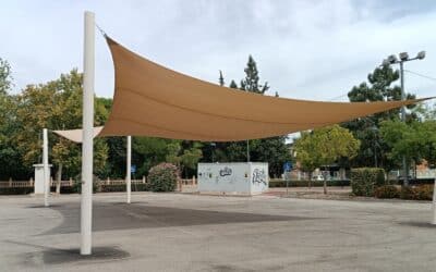
The Cehegín City Council, through the Northwest Tourism Services Association, has installed a new climate shelter in Ginés Ibáñez Park with the aim of improving comfort...
The document outlines a roadmap to boost the gastronomy, agri-food products, and wine heritage of Bullas, Calasparra, Caravaca de la Cruz, Cehegín, Moratalla, and Mula....
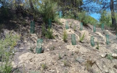
The Association of Tourism Services of the Northwest Region of Murcia has carried out a project to improve the green infrastructure of the "Ruta Verde" (Green Route),...
The Northwest Tourism Services Association continues to advance the modernization and digitalization of the tourism offerings in its member municipalities by acquiring...
La Mancomunidad de Servicios Turísticos del Noroeste de la Región de Murcia continúa avanzando en la transformación del modelo turístico del territorio con la...
The Caravaca City Council improves the Paseo de Santa Clara with new sidewalks and the reorganization of the parking area. The project, integrated into the 'Tierras de...