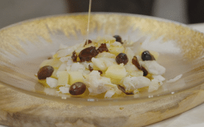
The document outlines a roadmap to boost the gastronomy, agri-food products, and wine heritage of Bullas, Calasparra, Caravaca de la Cruz, Cehegín, Moratalla, and Mula....


Here, the land is experienced step by step or by the turn of a pedal.
If you’re looking for a quiet stroll to disconnect, the Northwest Greenway and the Green Ring are our daily escapes, ideal for families and unhurried walkers.
For cyclists, the menu ranges from more relaxed routes through our local villages to the demanding climb up Collado de la Cruz, a stage of the Vuelta a España.
And if you’re moved by faith or history, join the thousands of travelers who arrive via the Ways of the Cross or follow in the footsteps of Saint John of the Cross.
Caravaca is an ideal place for those who enjoy walking and connecting with nature. Additionally, the region’s climate makes each season invite you to discover Caravaca from a different perspective, always accompanied by its history and nature.
Advanced-level route for lovers of pure MTB, between the municipalities of Caravaca de la Cruz and Moratalla. You'll enjoy the most authentic landscapes and areas completely removed from civilization where you'll test your fitness and your skills on the bike. Dirt tracks, trails, paths... As the finishing touch to your experience, make sure to book at one of the restaurants you'll find on turismocaravaca.com Circular route from Parroquia El Salvador passing through: - Fuente Nevazo (26.4 km) - Nevazo de abajo (28.7 km) - Fuente los frailes (31.0 km) - Templete (32.9 km)
35 Km | Difficulty: High
Ready to test your fitness? You'll need to give it your all on this route. You'll find powerful climbs like the Collado de La Cruz de Caravaca, the finish of the 9th stage of the 2023 Vuelta a España, which will send your endorphins to stratospheric levels. When you finish this route, you're going to need a good refreshment at one of the restaurants in Caravaca. Pro tip: Book in advance! Circular route from El Salvador Parish passing through: - Fuente los frailes (2.2 km) - Collado del Castillico (6.5 km) - La Alberquilla (8.6 km) - Cortijo de los Álamos (38.9 km) - Cuevas del Marqués (85.8 km)
85 km | Difficulty: High
Explore the rural world of Caravaca de la Cruz. This intermediate-level road route allows you to discover the municipality's most beautiful backroads. Enjoy traffic-free areas, filled with diverse landscapes that will surprise you. Upon your return, to perfectly conclude this adventure, we recommend reserving a table at one of Caravaca's restaurants where you can savor the typical local cuisine and stroll through the historic old town. What are you waiting for to get started!
53 km | Difficulty: Medium
Intermediate-level route that will take you through much of the municipality of Caravaca. Get ready to discover some of its best-kept secrets, known to very few people. From archaeological sites, natural water springs, historic buildings, the ethnic music museum in Barranda, and a contrast of unique landscapes in the Region of Murcia. The route surface is 70% road, 30% dirt tracks. Get your bike ready for this great adventure through rural and authentic lands—you're going to love it!
50 km | Difficulty: Medium
An easy circular bike route for everyone. It follows part of the Camino de Levante. Our route starts and ends at Plaza del Arco, in Caravaca’s historic centre. We’ll visit the natural area of Las Fuentes del Marqués. Then we’ll head towards Cehegín, riding along part of the Camino de Levante, a route used by pilgrims on their spiritual journey from Orihuela to Caravaca. Ready to enjoy a different kind of experience?
24 km | Difficulty: Low
A very easy circular route for the whole family. Discover some of the most iconic landmarks, such as El Templete, and the most beautiful natural landscapes of Caravaca like Las Fuentes del Marqués. The start and finish of our route will be from Plaza del Arco, in the historic center of Caravaca. A bike route for users eager to embark on new adventures with family or friends. We hope you enjoy it!
14 km | Difficulty: Low
The GR 127 is a river trail that follows the course of the Segura River from the Cenajo reservoir to its mouth, offering a route that, in its section through the Region of Murcia, crosses key municipalities such as Calasparra and passes through the hamlet of Salmerón in Moratalla. Although its total length is not defined by a single figure, it is divided into significant stages, such as the one from Calasparra to Cieza (35 km), and is characterized by easy to moderate difficulty, as the elevation changes are generally gentle when following the river course, although the length of the stages can be considerable. The essence of the GR 127 lies in its deep connection with water and riverside landscapes. In Calasparra, the route allows hikers to immerse themselves in the heart of the famous rice fields, a landscape of great beauty and uniqueness, especially during the rice growing seasons. The trail also leads to the Sanctuary of Our Lady of Hope, an iconic site carved into the rock beside the river, which is a pilgrimage point and a major tourist attraction. In addition, the GR 127 offers privileged views and access to the impressive Almadenes Canyon, a natural gorge carved by the Segura between Calasparra and Cieza, with its imposing vertical walls and prehistoric caves. The trail also crosses fertile plains, historic bridges, and areas of riverside vegetation, providing a rich and diverse ecosystem. It is a route that allows you to understand the importance of the Segura River in the history and development of the Region of Murcia, offering a peaceful experience deeply connected to the river landscape. The Caravaca de la Cruz Town Council is not responsible for the content of published texts or the state of signage, maintenance, or safety of the routes described.
Por etapas | Difficulty: Medium
This branch of the GR 7 is a specific 62.7-kilometer trail that directly connects the towns of Moratalla and Caravaca de la Cruz. With moderate difficulty due to the elevation changes typical of the northwestern Murcia terrain, the GR 7.1 is an excellent option for a 2 to 3-day trek, offering a route that combines natural landscapes with a strong cultural and spiritual component. The trail begins in Moratalla, a mountain village with particular charm, and enters a natural environment that includes ravines, river valleys, and pine forests. The route winds through the rural and mountainous landscape, often following the course of rivers such as the Alhárabe or the Argos, which carve deep and fertile valleys. Hikers experience a sense of immersion in the most pristine nature of the Northwest, with the possibility of spotting local wildlife and enjoying the tranquility of its forests. As the route approaches Caravaca de la Cruz, the pilgrimage character becomes more evident. The trail becomes part of the Ways of the Cross, culminating at the Basilica-Sanctuary of the Vera Cruz, the final destination for pilgrims. This GR 7.1 not only offers a physical challenge but also a deep connection with the history and traditions of the region, linking two of its most significant towns through a landscape that invites reflection and enjoyment of nature. The Town Council of Caravaca de la Cruz is not responsible for the content of published texts or the state of signage, maintenance, or safety of the routes described.
62,7 km | Difficulty: Medium
Spanning 134 kilometers, the GR 251 is one of the "Caminos de la Cruz" (Ways of the Cross) that converges in Caravaca, starting from the Altiplano wine-growing region. This moderate-difficulty trail directly links the municipalities of Calasparra, Moratalla, and Caravaca de la Cruz, offering a fascinating journey through landscapes that contrast vineyards with rugged mountains and river plains. The estimated time to complete it on foot is 5 to 6 days, depending on your pace and stops. The route begins in the plains and mountains of the Altiplano, featuring extensive vineyards and arid landscapes that evoke the essence of the interior. As it moves west, the trail enters the Northwest region, where the scenery transforms. In Calasparra, the path skirts the famous rice fields that the town is known for and approaches the Sanctuary of Nuestra Señora de la Esperanza, a site of great devotion carved into the rock beside the Segura River. Here, the GR 251 often overlaps or crosses with the GR 7 and the GR 127 (Segura River), offering opportunities to diversify your hiking experience. Continuing toward Moratalla, the path crosses mountain areas and river valleys, such as those of the Alhárabe and Benamor rivers, offering panoramic views and the chance to explore untouched natural environments. Finally, the trail culminates at the Basilica-Sanctuary of the Vera Cruz in Caravaca, a perfect finish to a route that connects not only geographies but also traditions and the region's deep connection to its roots. It is a route that combines natural beauty with a strong cultural and spiritual character. The Caravaca de la Cruz Town Council is not responsible for the content of the published texts or the condition of the signage, maintenance, or safety of the described routes.
134 km | Difficulty: Medium
This Long-Distance Trail, spanning nearly 140 kilometers divided into 5 stages, stands as another artery of the "Caminos de la Cruz" (Ways of the Cross) leading to Caravaca de la Cruz, starting from the coast of Mazarrón and the Bajo Guadalentín region. Its difficulty varies, with moderate sections and some, like the one crossing Sierra Espuña, demanding considerable physical effort, making it an attractive challenge for experienced hikers. The municipalities of Mula (via Zarzadilla de Mula), Bullas, Cehegín, and Caravaca de la Cruz are part of its extensive route. The route is a mosaic of Murcian landscapes and ecosystems. It begins in a coastal environment, ascends towards the impressive formations of Sierra Espuña, a Regional Park of immense ecological value with dense forests and rugged terrain. In this mountain range, the trail offers spectacular panoramic views and the opportunity to connect with unspoiled nature. As it progresses, the GR 252 ventures inland, crossing river valleys such as the Pliego River and the Mula River, agricultural areas, and places of unique beauty. Numerous points of interest adorn the path, inviting visitors. The route overlaps with sections of other greenways, such as the Mazarrón to La Pinilla Greenway and the Cartagena to Totana Greenway, and even converges with the Northwest Greenway in its final stretch towards Caravaca, facilitating the interconnection of routes. The trail passes through small villages and hamlets like El Berro, Gebas, or Zarzadilla de Mula, offering an immersion into Murcian rural life and culminating, like other Caminos de la Cruz, at the emblematic Sanctuary of the Vera Cruz, making this GR a complete experience of nature, culture, and spirituality. The Caravaca de la Cruz City Council is not responsible for the content of the published texts or the condition of signage, maintenance, or safety of the described routes.
140 km (en 5 etapas) | Difficulty: High
The GR 250 is a Long-Distance trail that's part of the vast "Caminos de la Cruz" network, designed to connect the port city of Cartagena with the sacred Caravaca de la Cruz. Stretching over 143.49 kilometers, this path offers a moderate hiking experience, with stages that vary in length and elevation gain, and can be completed in about 6-7 days. Its route runs through the municipalities of Mula, Bullas, Cehegín, and Caravaca de la Cruz, making it a central route for exploring this region. The diverse landscape is one of its main highlights. The trail starts on the coast and progressively heads into the interior of the Region of Murcia, crossing the Campo de Cartagena, the fertile plains of the Segura and Mula rivers, and the Northwest regions. A distinctive feature of this GR is its use of sections of the Northwest Greenway, which makes progress easier in certain parts and lets you enjoy its infrastructure and scenery. Along the way, hikers will find numerous points of cultural and natural interest. In Mula, you can visit its old town and rural surroundings. Passing through Bullas, you'll dive into its winemaking tradition and characteristic landscape. Cehegín surprises with the Begastri Archaeological Park, a site of great historical value that tells the story of human occupation since ancient times. Finally, the route ends in Caravaca de la Cruz, the city of the Vera Cruz, with its impressive sanctuary and rich religious and cultural heritage. The Apostle's Way isn't just a trail, but a journey through the history and soul of the Region of Murcia. Caravaca de la Cruz City Council is not responsible for the content of the published texts or the condition of the signage, maintenance, or safety of the described routes.
143,49 km | Difficulty: Medium
Utilizing the old railway line between Murcia and Caravaca de la Cruz, whose construction began in 1925 and concluded in 1931, the Vía Verde (Greenway) stretches for nearly 78 km, passing through lush orchards, pine forests, and the most beautiful spots. Along its route, hostels are set up in old train stations. This route constitutes the final stretch of the Camino de Levante, the pilgrimage route to the Holy City of Caravaca de la Cruz.
78,03 km | Difficulty: Low
This is the longest and most demanding route among those proposed in Caravaca de la Cruz, designed for highly experienced hikers or to be completed in two stages. The trail starts at Fuente de los Frailes, a natural site linked to the area’s history, and leads into a vast territory that includes mountain areas, valleys, and the Rambla Béjar basin. The route is varied, with sections of pine forest, scrubland, and more arid or rocky terrain. The total distance and cumulative elevation gain throughout the day are considerable, requiring excellent physical condition and navigation skills. It is a unique opportunity to explore the most remote and unspoiled corners of the municipality, enjoying the solitude and grandeur of its landscape. The Town Hall of Caravaca de la Cruz assumes no responsibility for the content of the published texts or for the condition of signage, maintenance, or safety of the described routes.
30 km | Difficulty: High
A route that challenges with its length and climbs, venturing into the dense and wild pine forests surrounding Caravaca de la Cruz. The name refers to the dark coloration of certain forest areas and the presence of birds of prey such as the sparrowhawk. The trail combines forest tracks with narrow and steep paths that climb to higher elevations of the sierra. The effort of the ascents is rewarded with the vastness of the wooded landscapes and the views from the highest points, offering sweeping vistas over large parts of the region. It is an ideal route for those seeking a fully immersive experience in the Mediterranean forest, with the chance to spot wildlife and enjoy the silence of nature. The Town Hall of Caravaca de la Cruz assumes no responsibility for the content of the published texts or for the condition of signage, maintenance, or safety of the described routes.
15 km | Difficulty: High
This trail explores the diverse landscape of Caravaca de la Cruz, venturing into shaded ravines and climbing to viewpoints with wide panoramic views. The route begins in lower areas and then ascends through the Barranco del Agua, a place that may carry water during rainy periods. The path becomes more demanding as elevation is gained, leading to Loma Victoria, a high point offering spectacular views of the Sierra de Burete, the Valle del Argos, and Caravaca de la Cruz itself. The route passes through pine forests, Mediterranean scrub, and dry farming areas, showcasing the ecological and scenic richness of the region. Its length and elevation gain make it suitable for hikers with some experience and good physical condition. The Town Hall of Caravaca de la Cruz assumes no responsibility for the content of the published texts or for the condition of signage, maintenance, or safety of the described routes.
15 km | Difficulty: Medium
This circular route is a true oasis of water and vegetation in the surroundings of Caravaca de la Cruz. Starting from the town center, the trail heads towards the area of Las Fuentes del Marqués, a protected natural space where numerous springs emerge, giving rise to the río Argos. The path gently climbs through pine forests and Mediterranean woodland, offering views of the vega and the surrounding sierras. El Nevazo is an area of peaks and rocky escarpments which, although not directly climbed, provides a majestic backdrop. The route combines sections of forest track with narrower trails, allowing visitors to enjoy the water richness, the freshness of the forests, and the tranquility of the rural environment close to the town. It is ideal for a day of connection with nature. The Town Hall of Caravaca de la Cruz assumes no responsibility for the content of the published texts or for the condition of signage, maintenance, or safety of the described routes.
12 km | Difficulty: Medium
The document outlines a roadmap to boost the gastronomy, agri-food products, and wine heritage of Bullas, Calasparra, Caravaca de la Cruz, Cehegín, Moratalla, and Mula....
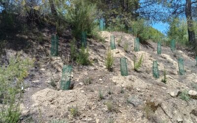
The Association of Tourism Services of the Northwest Region of Murcia has carried out a project to improve the green infrastructure of the "Ruta Verde" (Green Route),...

The Northwest Tourism Services Association continues to advance the modernization and digitalization of the tourism offerings in its member municipalities by acquiring...
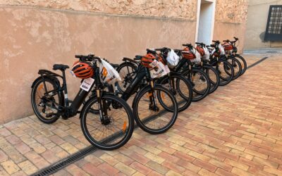
La Mancomunidad de Servicios Turísticos del Noroeste de la Región de Murcia continúa avanzando en la transformación del modelo turístico del territorio con la...
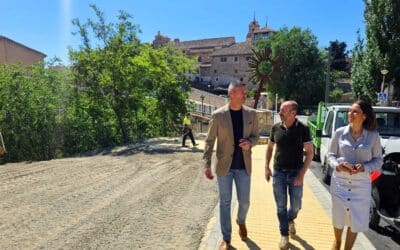
The Caravaca City Council improves the Paseo de Santa Clara with new sidewalks and the reorganization of the parking area. The project, integrated into the 'Tierras de...
PRESS RELEASE Boosting the tourism sector in Northwest Murcia through a business mentoring program funded by NextGenerationEU The Northwest Region of Murcia, under the...
Accommodation
Businesses
Gastronomy
Places
Routes
Accommodation
Businesses
Gastronomy
Places
Routes